Professional Drone Pilots in Virginia: Elevating Aerial Services with Precision and Innovation
Why Expert Drone Operators Are Essential for Modern Businesses, Real Estate, Construction, and Public Safety Across Virginia
Why Expert Drone Operators Are Essential for Modern Businesses, Real Estate, Construction, and Public Safety Across Virginia
Modern industries increasingly rely on advanced aerial imaging, mapping, and inspection services—and the demand for professional drone pilots in Virginia continues to surge. From real estate marketing to infrastructure inspections, expert UAV operators offer unmatched accuracy, efficiency, and safety. This blog explores the increasing value of certified drone professionals, how they transform operations, and why choosing skilled pilots is the key to unlocking aerial success in Virginia’s evolving landscape.
The Rising Need for Professional Drone Operators in Virginia
Virginia is one of the fastest-growing states for drone technology adoption. With a strong presence of commercial enterprises, government agencies, construction development, and agricultural operations, the need for precise aerial intelligence is greater than ever. Professional drone pilots help bridge operational gaps by offering advanced services such as:
- High-resolution aerial photography
- 3D mapping and modeling
- Thermal inspections
- Roof and infrastructure assessments
- Real-estate videography
- Land surveying support
- Emergency response assistance
These capabilities provide insights that traditional ground-based methods cannot match—making drones essential tools for businesses and agencies across the state.
Benefits of Hiring Certified Drone Pilots
1. Safety and Compliance
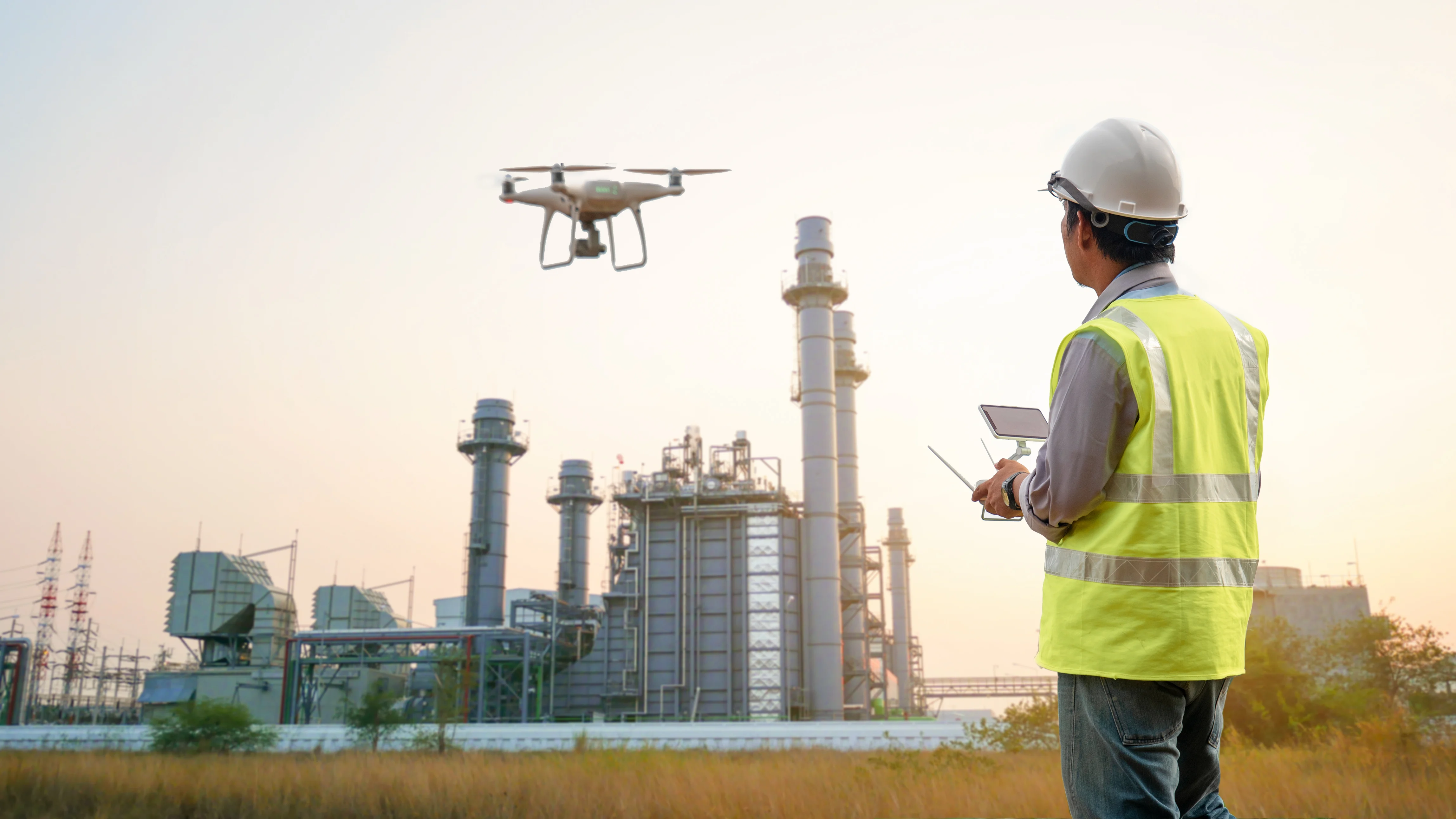
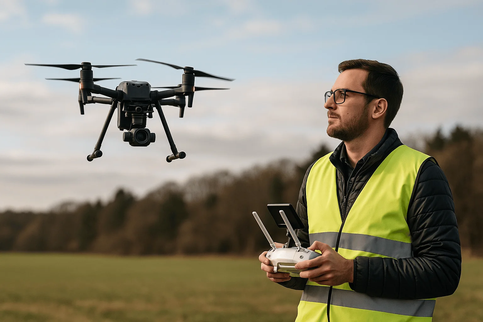
Licensed UAV pilots follow FAA Part 107 regulations, ensuring legal, safe, and risk-free operations. Complex environments—such as near airports, construction zones, or populated areas—require professionals who understand airspace and safety protocols.
2. Unmatched Expertise and Precision
Professional operators bring years of experience with automated flight systems, stabilized cameras, LiDAR, and thermal sensors. This expertise leads to more accurate data, smoother footage, and consistent results.
3. Time and Cost Efficiency
Traditional inspections or land surveys can take hours or days. Aerial operations significantly reduce field time, minimize manpower requirements, and eliminate unnecessary equipment costs.
4. Advanced Equipment and Technology
Most expert drone pilots invest in high-end UAVs such as DJI Matrice, Mavic 3 Enterprise, Autel EVO II, and others. This ensures access to superior flight stability, sensor accuracy, and advanced imaging quality.
5. Versatility Across Multiple Industries
Professional pilots provide customized solutions for:
- Real estate
- Construction progress tracking
- Utility inspections
- Public safety
- Search and rescue
- Agriculture monitoring
- Roofing and solar inspections
This versatility makes drone services valuable across nearly all commercial sectors.
How Drone Professionals Transform Key Industries in Virginia
Aerial Real Estate Marketing
High-definition aerial images and cinematic videos showcase homes, land parcels, and commercial properties in ways that ground photography cannot. Properties with aerial visuals often attract more buyers and sell faster.
Construction and Infrastructure
Contractors depend on drone data for progress tracking, volumetric analysis, site planning, and structural assessments. Drones reduce field risks and deliver accurate insights that help teams make faster decisions.
Roof, Solar, and Utility Inspections
Thermal imaging drones help detect:
- Water intrusion
- Heat loss
- Faulty solar cells
- Electrical issues
- Hidden structural damage
These inspections eliminate the need for ladders or scaffolding, improving safety and reducing labor costs.
Land Surveying & Mapping
While drones do not replace licensed surveyors, they support surveying professionals with precise elevation data, 3D models, and georeferenced imagery. This accelerates planning and engineering workflows.
Agricultural Management
Drones track crop health, irrigation issues, soil conditions, and pest hotspots—helping farmers maximize yield while reducing costs.
Public Safety & Search Operations
Drone pilots assist first responders by providing live aerial views, night-vision imaging, and thermal scans. These missions improve safety and save critical time during emergencies.
Choosing the Right Drone Pilot in Virginia
When selecting a drone service provider, ensure they meet these criteria:
- FAA Part 107 certification
- Proper liability insurance
- Experience with the type of project
- Use of enterprise-grade equipment
- Professional portfolio and references
- Strong understanding of safety protocols
Reliable drone operators should also provide transparent communication, flight planning details, and post-project deliverables such as edited videos, orthomosaic maps, thermal reports, or inspection summaries.
Conclusion
The demand for highly skilled drone operators continues to expand across Virginia, driven by the need for accurate data, advanced imaging, and efficient aerial solutions. Whether you're a business owner, real estate developer, contractor, or public agency, partnering with professional drone pilots ensures safety, precision, and exceptional results. For businesses seeking top-tier aerial services backed by experience and innovation, Skyintelli, Inc remains a trusted partner in delivering high-quality drone solutions across Virginia.
Frequently Asked Questions (FAQs)
Address: 13224 Piedmont Vista Drive, Haymarket VA 20169
Phone: +1 703-819-5244
Email: tom@skyintelli.com
1. Do I need a certified drone pilot for commercial aerial work in Virginia?
Yes. FAA Part 107 certification is required for all commercial drone operations in the U.S.
2. Are drone inspections safer than manual inspections?
Yes. Drones eliminate the need for climbing roofs, towers, or hazardous areas.
3. What industries commonly use drone services in Virginia?
Real estate, construction, agriculture, utilities, public safety, and land development.
4. How long does a typical drone project take?
Most projects take between 30 minutes and 2 hours depending on site size and complexity.
5. Can drone pilots capture 4K video footage?
Professional pilots typically use 4K or higher-resolution cameras.
6. Do drone operators provide edited photos and videos?
Yes. Deliverables often include edited images, videos, maps, and inspection reports.
7. Are drone flights allowed near airports in Virginia?
Yes, but only with FAA-approved airspace authorization.
8. Can drones operate during bad weather?
Strong winds, rain, or heavy fog can restrict flight operations for safety reasons.
9. How much do drone services cost in Virginia?
Pricing varies based on project type, location, and required deliverables.
10. How can I book professional drone services?
Contact the provider directly by phone at +1 703-819-5244 or email tom@skyintelli.com to discuss project requirements.